


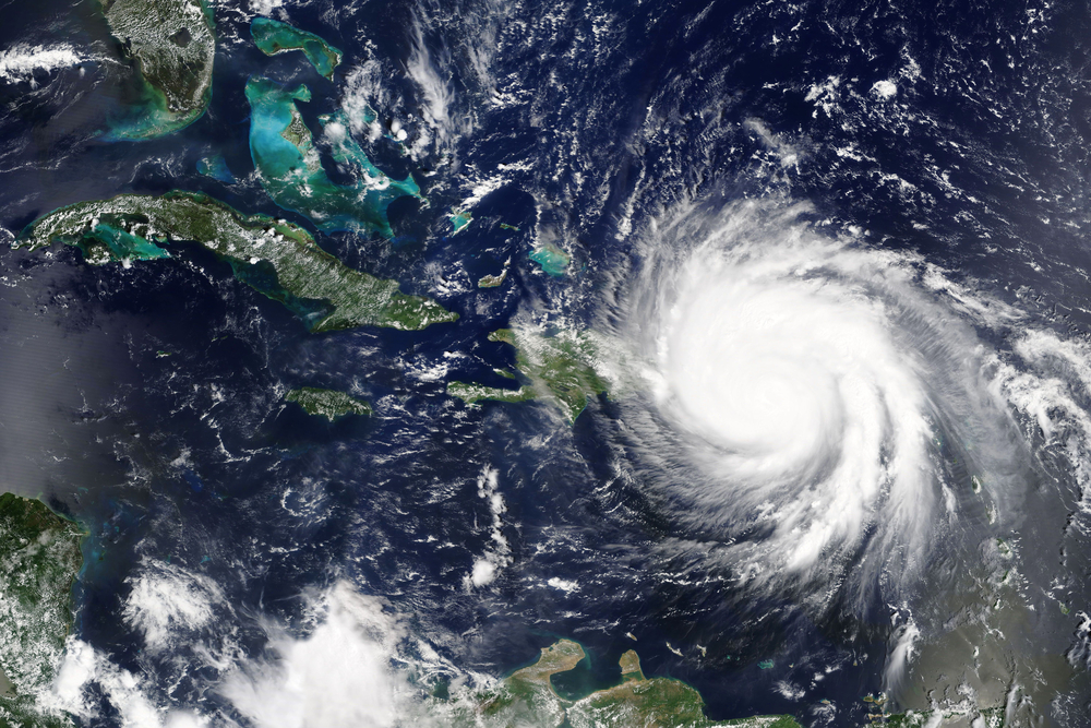
The Air Force recently highlighted the ability of Eagle Vision, technology that is capable of processing satellite imagery in near real-time, to assist in humanitarian assistance and disaster relief efforts, including those the aftermath of Hurricane Maria in Puerto Rico.
First deployed during the Gulf War in the 1990s using French satellite imaging technology, Eagle Vision can be embedded in existing systems used by airman, combatant commands, government agencies and international partners to collect and disseminate satellite data.
“From those early days, the partnership with the French was crucial in developing Eagle Vision,” said Senior Executive Service member James Clark, director of intelligence, surveillance and reconnaissance modernization and infrastructure, and deputy chief of staff for Intelligence, Surveillance and Reconnaissance (ISR). “That partnership and their expertise laid the groundwork.”
Following Hurricane Maria, Eagle Vision was used to plan routes to reach disaster victims, to analyze landing zones for helicopters, and to identify and limit potential hazards. Senior Master Sgt. John Barr, combat control functional manager for the Air National Guard Ground Special Operations Forces, having current imagery streaming directly to devices was critical because the island didn’t look anything like it did before Hurricane Maria struck.
“It’s a system we use all the time, for every major conflict and disaster response since 2000,” Clark added.